
Written by: The Editorial Team
Published: 22 Oct 2026
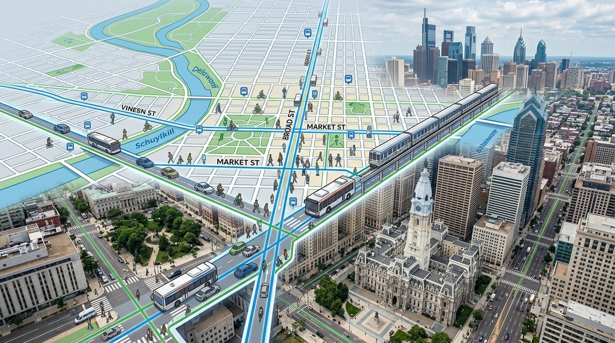
The first time you look at a map of Center City Philadelphia, the pattern is almost hypnotic. Straight lines. Right angles. A neat grid of numbered streets running north to south, and tree-named streets running east to west. It feels orderly, almost too orderly for a city that’s over 340 years old. But that grid isn’t just a cartographer’s trick. It is the direct result of a single, ambitious plan drawn up by William Penn in 1682. That plan, known as the Philadelphia street grid history, has dictated everything from your morning commute to the way neighborhoods developed. Understanding it helps you see the city in a whole new light.
Philadelphia’s street grid is not random. It was a deliberate design by William Penn to create a "greene countrie towne" with wide streets, public squares, and a predictable layout. This 1682 plan made Philadelphia the first planned city in North America. The grid still governs traffic flow, property values, and daily life in 2026. Knowing its history helps you navigate smarter and appreciate the city's unique character.
The Vision Behind the Grid
William Penn founded Pennsylvania as a "Holy Experiment." He wanted his capital city to reflect his Quaker values of order, equality, and openness. He looked at the crowded, winding streets of European cities like London and decided to do the opposite. He hired surveyor Thomas Holme to design a city that was spacious and easy to navigate.
The original plan was simple. A grid of streets was laid out between the Delaware and Schuylkill Rivers. The grid covered about 1,200 acres. Streets were 50 feet wide, and major thoroughfares like Market Street were 100 feet wide. This was unheard of at the time. Most colonial streets were narrow and chaotic. Penn’s plan gave Philadelphia a head start in urban planning.
How the Grid Breaks Down
The grid is built on a clear system. Numbered streets run parallel to the rivers. They start at the Delaware River with Front Street and go west to the Schuylkill. The named streets, like Walnut, Chestnut, and Market, run perpendicular. Market Street is the center line. Everything north of Market is a named street, and everything south is also a named street, but the names change.
Here’s a breakdown of the key elements:
- The Five Public Squares: Penn’s plan included five squares: Center Square (now home to City Hall), and four quadrant squares: Rittenhouse, Washington, Franklin, and Logan. These were meant to be public gathering spaces.
- Wide Streets: The width of Market Street allowed for public markets. Broad Street, which bisects the grid north-south, was designed as a grand boulevard.
- Rectangular Blocks: The standard block size is about 400 by 500 feet. This made land easy to sell and develop.
This structure is why you can stand at 2nd and Market and know exactly how to get to 20th and Walnut. You just count.
Why the Grid Makes Your Commute Easier
For commuters, the grid is a gift. It reduces the mental load of driving. You don’t need GPS as much. If you know your destination is on 15th Street, you know you need to travel 13 blocks west from 2nd Street. Traffic flows in straight lines, which makes bus routes predictable. SEPTA’s main routes, like the Market-Frankford Line and the Broad Street Line, follow the grid’s logic.
But the grid isn’t perfect for cars. The regular blocks create frequent intersections. This can mean more stops. However, for pedestrians and cyclists, the grid is ideal. You can walk a straight line without detours.
A Table of Grid Features
Let’s look at how the grid compares to other city layouts. This table clarifies the advantages and quirks.
| Feature | Philadelphia Grid | Boston Layout | Washington D.C. Layout |
|---|---|---|---|
| Street Pattern | Strict grid | Winding, organic | Grid with diagonal avenues |
| Founder | William Penn | Colonial settlement | Pierre L’Enfant |
| Primary Goal | Order and openness | Followed cow paths | Monumental vistas |
| Ease of Navigation | Very easy | Difficult | Moderate |
| Traffic Flow | Predictable | Unpredictable | Mixed |
The Squares as Neighborhood Anchors
The public squares are more than just green spaces. They anchor neighborhoods. Rittenhouse Square is surrounded by high-end apartments and restaurants. Washington Square is quieter, with a historic burial ground. Franklin Square has a playground and a miniature golf course. Logan Square is a traffic circle with a fountain. Each square gives its surrounding blocks a distinct identity.
This was part of Penn’s plan. He wanted each quadrant to feel like a village. Today, that translates into real estate value. Properties near the squares are some of the most desirable in the city.
"The grid is the skeleton of Philadelphia. The squares are the heart. Without the grid, the city would be a confusing mess. Without the squares, it would be a concrete jungle." — A local urban planning professor
How to Navigate Using the Grid
If you are new to Philadelphia, here is a practical way to use the grid to your advantage. Follow these steps to get anywhere in Center City.
- Find your axis. Determine your current street and your destination street. Are you on a numbered street or a named street?
- Count the blocks. If you are at 5th and Market and need to get to 15th and Chestnut, you know you need to walk 10 blocks west (from 5th to 15th) and one block north (from Market to Chestnut).
- Use Market Street as zero. Market Street is the dividing line. North of Market, the numbered streets don’t change. South of Market, the same system applies.
- Look for the squares. If you get lost, find a square. City Hall (at Center Square) is the most visible landmark.
- Remember the river boundaries. The Delaware is to the east, the Schuylkill is to the west. You can’t walk too far in one direction without hitting water.
The Grid’s Influence on Culture
The grid doesn’t just affect navigation. It shapes culture. Because streets are straight and blocks are consistent, people walk more. This creates street life. Cafes, shops, and restaurants thrive on corners. The grid makes it easy to explore on foot.
The grid also influenced the city’s famous row houses. Because lots were narrow and deep, builders constructed attached homes. This gave Philadelphia its iconic look. The grid encouraged density, which in turn fostered community.
Common Mistakes Visitors Make
Even with a perfect grid, people get confused. Here are the most common errors.
- Confusing North and South: Many people assume that all named streets are north of Market. They are not. South Street is south of Market. So is Pine, Spruce, and Lombard.
- Forgetting the Diagonal Streets: A few streets, like Benjamin Franklin Parkway, cut diagonally across the grid. These can disorient you if you rely only on the grid.
- Ignoring the River Wards: The grid is strongest in Center City. Once you go north of Girard Avenue or south of Washington Avenue, the grid starts to break down.
Why the Grid Still Matters in 2026
In 2026, Philadelphia is still growing. New developments in neighborhoods like Fishtown and University City follow the grid’s logic. City planners use the grid as a baseline for new projects. The grid also helps with infrastructure. Water lines, sewer systems, and fiber optic cables are easier to install when streets are straight.
The grid also supports the city’s sustainability goals. Walkable neighborhoods reduce car dependency. The grid makes public transit more efficient. This is why Philadelphia is often ranked as one of the most walkable cities in the United States.
The Grid as a Living Document
The Philadelphia street grid history is not just a story about the past. It is a living document that continues to shape the present. Every time you walk down Walnut Street or drive up Broad Street, you are following a plan that is over three centuries old. That is a remarkable legacy.
Next time you are in Center City, take a moment to appreciate the straight lines. Notice how easy it is to get from one square to another. Think about William Penn, standing on a muddy bank of the Delaware River, imagining a city of order and light. His grid made that vision real. And it still works today.
Was this page helpful?
Our commitment to delivering trustworthy and engaging content is at the heart of what we do. Each fact on our site is contributed by real users like you, bringing a wealth of diverse insights and information. To ensure the highest standards of accuracy and reliability, our dedicated editors meticulously review each submission. This process guarantees that the facts we share are not only fascinating but also credible. Trust in our commitment to quality and authenticity as you explore and learn with us.